Greater Taos Area Map
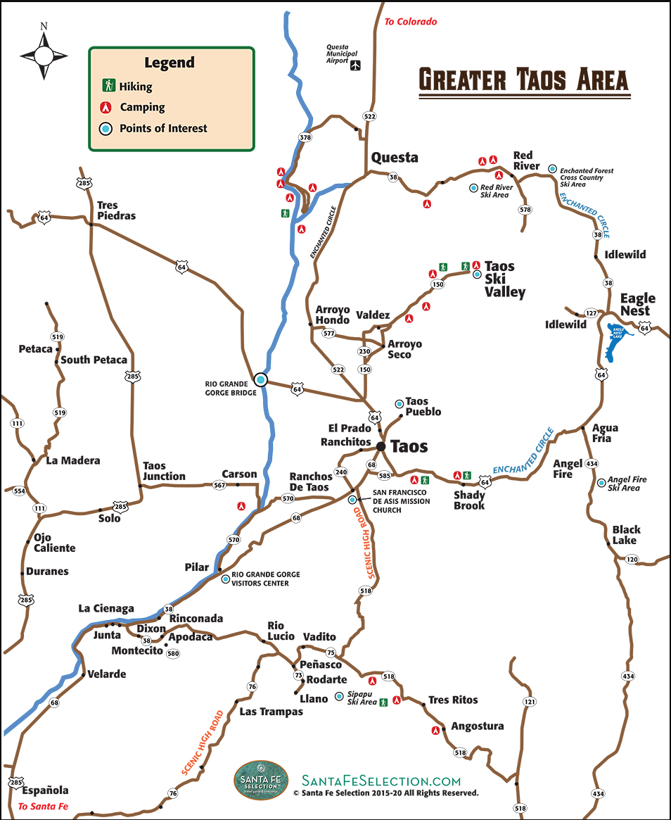
Use our easy reference map to journey the Scenic High Road to Taos, The Enchanted Circle, Taos Pueblo, and points of interest, hiking trails, and camping areas in the Taos vicinity. Click to enlarge image and download into your mobile device.
Quick Info
Need Help Planning?
Let us build your perfect Santa Fe itinerary around places like this.
More to Discover
You Might Also Love

Map of Downtown Historic Santa Fe
(Click To Enlarge) For optional offline use you can save the enlarged image to your mobile device: After you open the full-sized map, press and hold any point on the image, then on the pop-up menu choose "save image" and you will be able to retrieve the image from your saved folder even when cell coverage is not available.

Santa Fe Major Streets Map
This map shows the major streets throughout Santa Fe, making it easy for you to get off the beaten path and into innovative areas, such as Midtown, and Southside. Download into your smart phone and no GPS required.

Day Trip Map of Northern New Mexico
No GPS required. This color coded map will help guide you to points of interest and Native American sites as you explore the Northern New Mexico region.